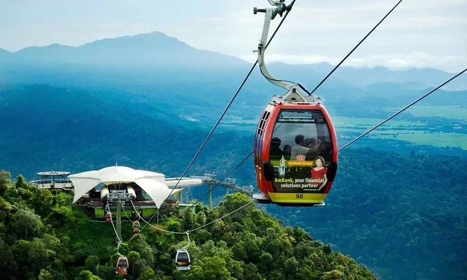
LANGKAWI SKYBRIDGE CABLE CAR
The best way to see the beauty of Langkawi is when you’re 708m above sea level! Climb aboard the highest cable car ride in Malaysia and embark on a journey through the eastern cliffs of Mt. Machinchang and its summit. From the Base Station to the Middle Station, SkyCab will take you on a scenic ride 650m above sea level, covering over1,700m in distance. And once you reach the station, you’ll alight and make a short walk up the stairs to reach the Top Station where you’ll be pleasantly rewarded by spectacular views of the entire Langkawi archipelago and Southern Thailand. Have the option to choose a standard designed gondola or level up your sightseeing experience with a glass bottom gondola. If you are not a fan of waiting in long lines, you can take the convenient route and book the Express Lane or VIP Gondola ticket offer. Don't forget to check out the attractions at the station like SkyTrail, 3D Art Langkawi, SkyRex, and SkyDome - access is included in all packages, afterall!
VISITING HOURS
-
Everyday from 9.30am to 6pm
TICKET price
Adult
Child
Adult express lane
Child express lane
RM43
RM33
RM93
RM83
RM85
RM65
RM135
RM115
VISIT WEBSITE
You can get a 7% discount on these prices by buying online through Tripcarte's secure website with instant ticketing, fully refundable and hassle free e-tickets. The ticket price includes entrance to the SkyDome, a cinema showing simulated roller coaster ride lasting about 10 minutes and Sky Rex, a 3D dinosaur-themed experience & 3D Art Langkawi. Entry to the SkyBridge costs an additional RM6 for adults (RM4 for children).
Address: Jalan Telaga Tujuh, 07000 Langkawi, Kedah, Malaysia
E-Ticket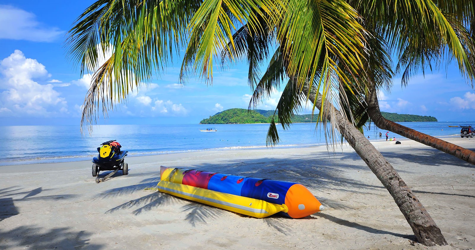
PANTAI CENANG
Pantai Cenang is the busiest beach town on Langkawi Island, where you can find a diverse mix of cafes and restaurants, as well as souvenir shops, and duty-free outlets along its picturesque beach strip. Just a 10-minute drive from Langkawi International Airport, it’s a popular holiday destination for travelling families thanks to its kid-friendly attractions such as Underwater World Langkawi, Rice Garden Museum, and Kiki Club at Meritus Pelangi Resort & Spa. Featuring white sands and clear waters, Pantai Cenang’s expansive beach is also great for sunbathing and exciting water sports such as jet skiing and parasailing. High-end resorts, chalets and budget hotels with views of the Andaman Sea are aplenty here, attracting throngs of locals, expats, backpackers, and foreign tourists. Pantai Cenang’s nightlife scene is the liveliest on Langkawi Island.

CROCODILE ADVEN.
Discover the "The largest Crocodile Adventureland in Langkawi" with exciting Crocodilian Education Talk Show, Juvenile crocodile fishing & feeding. Get close up with different species of crocodiles in the world and snap photo with "live" Juvenile crocodile. Fill your day with fun, smiles and unforgettable memories! Crocodile Adventureland is located on the road to Teluk Datai Bay, about 32 miles north of Kuah. It is 20 hectares and is registered with the Convention on International Trade and Endangered Species. Locally, this park known as Taman Buaya Langkawi. Crocodile Adventureland is just one of the many attractions on the island of Langkawi. Crocodiles have always had a great attraction for children. Children can not get enough of these prehistoric looking animals to view and see how they live. Adults also get a kick when they see how crocodiles behave and fed in their natural environment. This is why the Crocodile Adventureland on Langkawi is a hit among adults and children.
VISITING HOURS
-
Open Daily 9AM-6PM
TICKET price
Click the visit website link or e-ticket button to know more about their ticket price and buy online ticket.
Address: Mukim Air Hangat, Jalan Datai, Kampung Kubang Badak, 07000 Langkawi, Kedah, Malaysia
E-Ticket
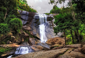
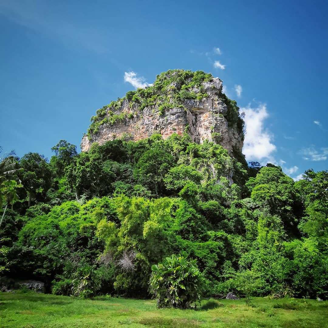
SEVEN WELLS WATERFALL
Known locally as Telaga Tujuh, Seven Wells Waterfall is so named because seven natural pools have been formed at different levels by water streams that flow down the second highest mountain of Langkawi - Mount Mat Cincang. This is the most picturesque and undoubtedly the best waterfall in the island. The total vertical fall is 91 meters and the lowest pool is formed at the bottom. Seven Wells Waterfall is located in Pantai Kok area and close to the Pantai Kok Beach and Oriental Village where the Cable Car ride takes place. You need to hike from the car park. There are two ways of watching the waterfall. If you are not too keen climbing and tiring yourself and like to take a quick look of the vertical waterfall, then take a short walk up the service road that leads from the car park and take the left turn to reach the bottom of the falls. You will get great view of the fall from here. If you want, you can even bathe at the natural shallow pool here. But the real fun is when you reach up to the top of the fall. And nothing comes easy. You can either continue along the steep service road (this time take the right instead) or take the stairs from the car park (behind the stalls) that goes all the way up to the top. There are 638 steps to climb and the total altitude at which you will finally reach the top of the waterfall is about 480 meters. There are signs on the way showing how many steps are remaining and height to climb further. So if you are going to the top, take easy and slow steps. The pathway goes through the rainforest of Mount Mat Cincang where you will hopefully see lots of flora and fauna including bird life.
PRECAUTION:There are few things to be careful about while at top of Seven Wells Waterfall. Do not stand on the edge of a rock. They can get very slippery at times and you may have a bad fall. The rocks at the bottom of the pools are also quite slippery, so take care while plunging into the pool or getting out of it. Second, do not go beyond the barricade area on top that has prominent warning signs. It is dangerous to go there as several fatal accidents have taken place there. The drop from there is 65 meters into the waterfall and there won't be any chance of survival.
VISITING HOURS
-
While I have noticed that pools here always have enough water for bathing, in order to enjoy the waterfall in its full flow, the monsoon season (September - October) would be the best time to visit. But that time, even the stairs to climb could be quite mossy and slippery. There is a resting place (a gazebo like structure) on top. However there is no changing room for swimmers. I didn't find the toilet in good condition either.
TICKET price
Entry is free and you can visit Seven Wells Waterfall anytime during the day time.
FACILITIES:
There are several shops near the car park at the bottom. Some of them sell fresh coconut water, quite refreshing after the hike. You will also get souvenirs, snacks and even ice creams at the stalls. Two and four wheeler paid parking is available (Car RM2 and Motor Bikes RM1). There is a visitors center at the base. You can also take a guide for the hike if you so want. But they may not be always available.
Location & How to Reach
Seven Wells Waterfall is further 2km north of Pantai Kok Beach. Once past Pantai Kok Beach (along the road Jalan Teluk Yu), take a right turn (into Jalan Teluk Tujuh) away from the Burau Bay beach. You will reach the Car Park in about 1km. It is about 27kms from Kuah Town. Although you can come here easily by a taxi, getting a taxi here for your return may be difficult. So come here either by a rental car or hire a taxi by the hour and keep the taxi waiting. There is no bus service to Seven Wells.
Address: Mukim, Jalan Telaga Tujuh, 07000 Langkawi, Kedah, Malaysia
UNESCO GEOPARK MANGROVE CRUISE
Kilim Geoforest Park is a place with Mangrove Forests, Million Years Old Fossils, Islands & Beaches, Amazing Caves and many more. Located at the east-side of Langkawi Island and about 20 minutes from Kuah Town, Kilim Geoforest Park is home to a sprawling mangrove forest and ancient gigantic limestone rocks formations rising from the river bed, formed some 500 million years back. The beauty of Kilim lies in its diverse natural geological, biological and cultural resources with high heritage value. It is also unique because it's the only place in Malaysia where one can find a coexistence of coastal karst and mangrove ecosystems.
-
ABOUT GEOFOREST PARK
A place with an ancient geological heritage, countless natural wonders, home to a myriad of flora and fauna, and a vibrant local community of Kilim Village. Kilim Geoforest Park (or Kilim Karst Geoforest Park as its full name) is one of the three geoforest parks associated with the Langkawi Geopark. The other two are the Machinchang Cambrian Geoforest Park and The Dayang Bunting Marble Geoforest Park. Langkawi Geopark comprises the whole of Langkawi Island, which is one of the districts of Kedah State, Malaysia. Langkawi started as a fishing village until its revelation as a UNESCO Geopark. Langkawi was endorsed as the 52nd Global Geopark by UNESCO on 1st June 2007, making it the 1st geopark in Malaysia and the South East Asia region. This endorsement was given due to its significant geoheritage features like landscapes, caves sea arches and sea stacks, dropstones, fossil and local community involvement. Langkawi Geopark is a member of the Asia Pacific Geoparks Network and The Global Geoparks Network (GGN).
-
BEAUTY OF KILIM GEOFOREST PARK
Not so long ago, Kilim was a laid back place where people’s activities are connected mainly to small scale fishing. Today, Kilim can be regarded as the most successful ecotourism destination in Langkawi where economic activities have vastly improved. The beauty of Kilim lies in its diverse natural geological, biological and cultural resources with high heritage value. These elements have been the pillars for the success of Kilim’s ecotourism. Among the remarkable features found here are the pristine mangrove and limestone forests, dramatic karstic landscapes and landform and colourful cultures. Kilim is also unique because it is the only place in Malaysia where one can find a coexistence of coastal karst and mangrove ecosystems. These unique landscapes provide new experience to tourists who flock this area to observe a wide spectrum of geological heritage diversity, such as various types of rock, beautiful caves, coastal and island karst morphologies, fossils, as well as rich mangrove fauna and flora.
-
VISITING HOURS
Everyday from 8am to 6pm
-
TICKET PRICE
Please visit their official website link provided here to know the ticket price, buying ticket online and every details about the tour.
TANJUNG RHU SEA BEACH
Located on the north eastern corner of Langkawi, Tanjung Rhu derives its name from the tall casuarina trees that line its shore. The word ‘Tanjung’ in Malay means a cape and ‘Rhu’ stands for Casuarina tree. This secluded beach has blue waters of the Andaman Sea, ivory white sand, and a mild, cool breeze. Tanjung Rhu has shallow waters for easy swimming, snorkelling or kayaking to explore the marine life of Langkawi. It is also a popular spot to watch the sunset, as dusk here is a display of vibrant shades of pink, orange, yellow and grey. During low tide, it is even possible to walk across the sea, to the nearest island of Pulau Chabang. The beach is frequented by families, couples and those seeking solitude away from the hustle and bustle of the main island. From the beach jetty, you can go on a boat tour to Kilim Geopark and Mangrove forests. Motor boats are also available for hire to visit the nearby islands with ancient limestone formations. Gua Cherita the caves of legend, can also be accessed from here. Although, Tanjung Rhu is a public beach, there are no toilets or changing rooms available, and only 450 meters of the beach is open to the public. The rest of the beach is shared by two luxury resorts the Tanjung Rhu resort and the Four Seasons. For a snack or a drink, it is best to bring your own or head to one of the restaurants inside the resorts.
How to reach Tanjung Rhu
-
Tanjung Rhu beach can be accessed from a road named Jalan Tanjung Rhu which is near the village Padang Lalan. Once on the coastal road, a diversion leads visitors all the way to the entrance of the beach. The coastal road runs along with famous hotels situated on both sides such as Tanjung Rhu resort. Soon comes a point where the coastal road meets the sand that marks the public area of Tanjung Rhu beach. The beach is at a distance of about 22 kilometres from Kuah Town and can be reached by a hired taxi. The fare of the taxi ride costs approximately RM40 from Kuah. Similarly, tourists may also rent cars for self-driving.
Best Time to Visit
The months of January to March are considered to be the peak tourist season in Tanjung Rhu. During these months, the region experiences no rainfall and the temperature rises as high as 35 degrees, marking a dry spell in Tanjung Rhu.
The following months of April to August, also known as the midseason witness occasional rainfalls with cloudy skies and short-lived thunderstorms. The temperature remains below 30 degrees post afternoon. The low season of September to October is the rainy season which brings about 2 hours of rainfall on average each day; but enough dry time in the rest of the hours.
Thus, for tourists who do not mind peak crowds, January to March is the best time to visit Tanjung Rhu Beach. During this season, the beach hosts several festivals and celebrations; plus the weather is suitable for beach activities like boating and snorkelling. Whereas, for tourists who would like to spend time in solitude, September to October is a good time to visit Tanjung Rhu beach as the region meets less number of tourists from around the world.
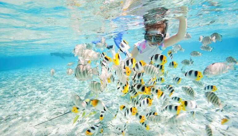
PULAU PAYAR
Pulau Payar Marine Park is a popular site for snorkelling and diving enthusiasts keen on exploring Langkawi’s undersea action. Just 30km south of the main island, it is about 45 minutes away from the Kuah jetty point and you can take either a catamaran or a speedboat to get here. Comprising four islands, the largest of which is Pulau Payar, and three smaller isles (Pulau Kaca, Pulau Lembu and Pulau Segantang) this marine park is spread over two nautical miles. None of these islands are inhabited and are strictly regulated by the Fisheries Department of Kedah to maintain their pristine condition. One of Pulau Payar Marine Park’s best features is its Coral Garden, a secluded section of the ‘park’ with colourful coral beautifully protected and preserved due to its sheltered waters. Those eager to explore the park will have to obtain permission from the authorities (fishing is strictly prohibited) before venturing into the waters: alternatively you can join a tour group. The park caters well to tourists with an extensive array of facilities ranging from picnic tables, barbecue pits, gazebos and restrooms set at strategic points throughout the park.
VISITING HOURS
-
Monday to Sunday 10:00 am - 7:00 pm
TICKET price
Please visit the website link provided here to know the ticket price, buying ticket online and every details about the tour.
How to reach pulau payar:
Visitors can get to Payar Island from the Kuah jetty point by catamaran or speed boat. The catamaran services operated by Langkawi Coral, takes about 45 minutes to get to Payar Island while the speed boat takes an hour. It is advisable to book the catamaran service a day before the trip. Enquiries can be made with any travel agent in Kuah or at the jetty point for those intending to travel by speed boat. Apart from the fare, a levy of RM5.00 for adults and RM2.50 for children is charged for entry to the marine park
E-Ticket
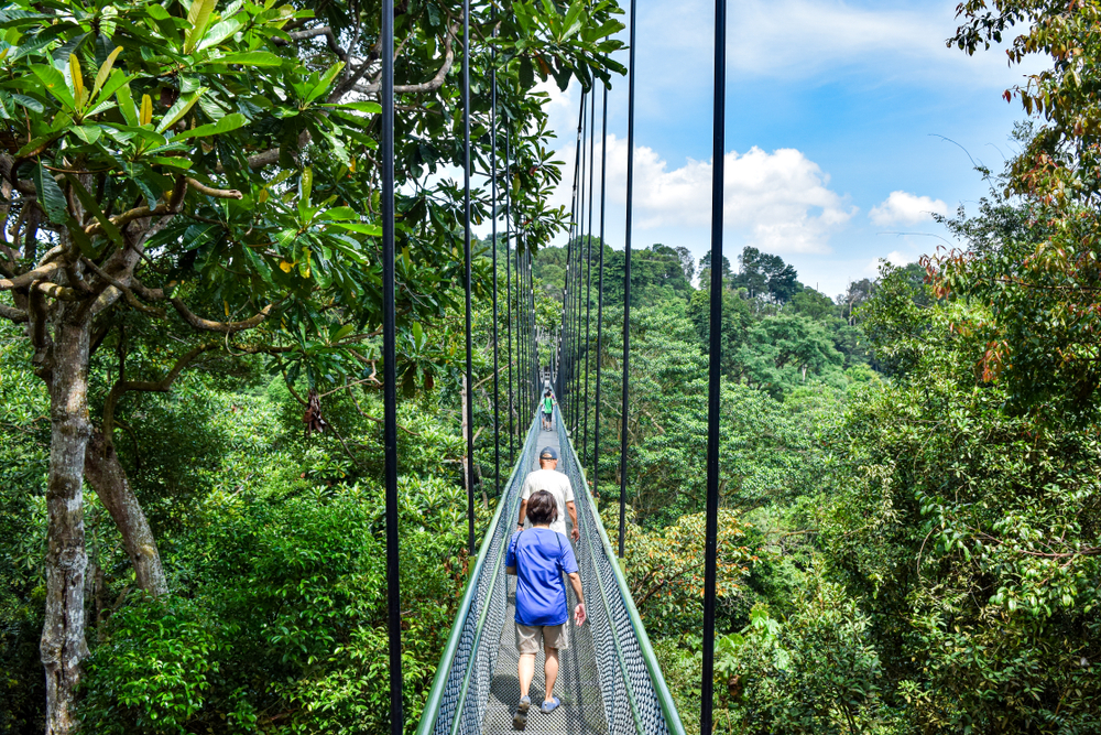
JUNGLE TREKKING TOUR
Hike in the rainforests at the foothill of Gunung Raya, with an opportunity to see Twiners, Liana, Bird’s Nest Fern, Cauliflory, Driptips, Buttressroots, Rattan, Rattan fruits, Oakleaf fern, Arboriens fern, earth fid and many other flora’s like flowering plants and wild mushrooms. You might be able to see Hornbill, White Bellied Sea-Eagle, Brahminy Kite, Kingfishers, Mynas, Little Heron, owls and many more birds, reptiles such as amphibians – Tokee, Gecko, Sunskink, gliding lizard, wild lizards, monitor lizards, wild frogs. You will be given ample information about the intricate system of fauna and flora in Langkawi’s rainforest jungle by a qualified Langkawi “Nature Guide.”
TICKET price
Please click the E-ticket button provided here to know the ticket price, buying ticket online and every details about the tour.
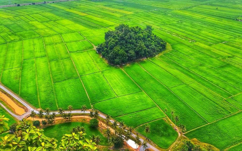
BUKIT KODIANG
Bukit Kodiang also known as Bukit Mok Cun or Bukit Hantu is well-known recently for its panaromic scenic view of paddy field from high up the hill. It is located in Kedah in a small rural area named Kodiang (Kampung Kodiang Lama), nearby Kodiang KTM station.
-
what is so special with it?
Bukit Kodiang is one of the hill that you can have a look of a full view of paddy field high from the summit & the scenery is fabulous! The beautiful-ness is just out of description. Here is one of the hiking destination you should come if you are a nature lover. If you are lucky enough, you can even witness the train passing through the middle of paddy fields.
Height: 140 meter (460 feet)
Time: Normally 20 to 45 minutes depends on personal fitness
Difficulty Level : 8.5/10 -
How to get there?
You can use waze "Bukit Kodiang" directly to reach here. You can park your car on a parking lot just right before the entrance. RM2 of parking fee is needed.
Is it dangerous?For a first timer, YES it is very dangerous. While for those who are confident enough, NO WORRY, you still can go by your own as the trek is clear and also come with ropes tying everywhere, just make sure to be extra careful.
When is the best time to come?
And for those with acrophobia, here is a good place for you to conquer your fear!
Starting of the trek is some muddy road with 60-75 degree steepness. After around 15-20 minutes of hiking, here comes the adventurous part. The trek comes with steepness of almost 90 degree and are mostly rocks and ropes to climb up. So basically, it is more of rock climbing rather than hiking. (HAHA)
Although the trek is short, but you will need good stamina and fitness to climb the hill as it requires quite good strength to pull yourself up with the rope & climb up the rocks.If you want to look for the greenery view of paddy field, you can pay a visit start from December to early January (Best at mid of December).
Address:
Kampung Kandis, 06100 Kodiang, Kedah, Malaysia
VISIT WEBSITE